Discover a New Side to Texas on These Scenic Hiking Trails
Looking for a good place to go hiking in Texas? There’s a lot of ground to cover, and a lot of excellent options. So we’ve pulled together the best trails in 11 of the most scenic places to hike in Texas.North Texas
1. Palo Duro Canyon State Park
Tucked away in the northern panhandle of Texas near Amarillo, the Palo Duro Canyon is affectionately known as the Grand Canyon of Texas. Its iconic Lighthouse rock formation can easily be reached along the 3-mile Lighthouse Trail right off State Highway Park Road 5, which loops through the center of the canyon. The beauty and ease of access makes this a favorite Texas hiking trail. Numerous other trails and red sandstone vistas make the Palo Duro Canyon State Park well worth visiting.
2. Caprock Canyons State Park & Trailway
About an hour and a half southeast of the Palo Duro Canyon, off State Route 256 near Silverton, a network of hiking trails cuts through the Caprock Canyons State Park & Trailway. The Haynes Ridge Overlook Trail to the northwest of the park is a popular hike with sweeping views of the surrounding canyon lands. Just outside the Caprock Canyons State Park, the Trailway is a 64-mile rails-to-trails project that extends from South Plains in the west to Estelline in the east. The trail is broken up into manageable sections that can be day hiked and includes passage through the Clarity Tunnel towards the west end.
South & Central Texas
3. Seminole Canyon State Park
Less than an hour northwest of Del Rio, TX, the Seminole Canyon State Park & Historic Site hugs the border of Mexico and the United States along the Rio Grande River. The 5-mile Canyon Rim Trail is the best way to explore this canyon right down to the Rio Grande, but the real magic is in the guided tours of the ancient rock art through Parida and Panther Caves. Check the events page to catch the next tour.
4. Lost Maples State Natural Area
Lost Maples State Natural Area offers something special for everyone. This fall haven among rolling hills covered in bigtooth maple trees is only an hour and forty-five minutes northwest of San Antonio, TX. Take the East Trail for a stroll along the Sabinal River before cutting back into the hills to make the steep climb to a scenic overlook.
5. Colorado Bend State Park
About 2 hours northwest of Austin, the Colorado Bend State Park sits in the heart of Texas. Out of its 35 miles of hiking trails, the 1.5-mile Gorman Falls Trail at the north end of the park is the most popular as it takes you to a 65-foot waterfall above the Colorado River. The park has much more to offer too, like the pools and waterfalls along Spicewood Springs Creek at the southern tip of the park, or the 3.4-mile River Trail that follows the Colorado River banks.
6. Enchanted Rock State Natural Area
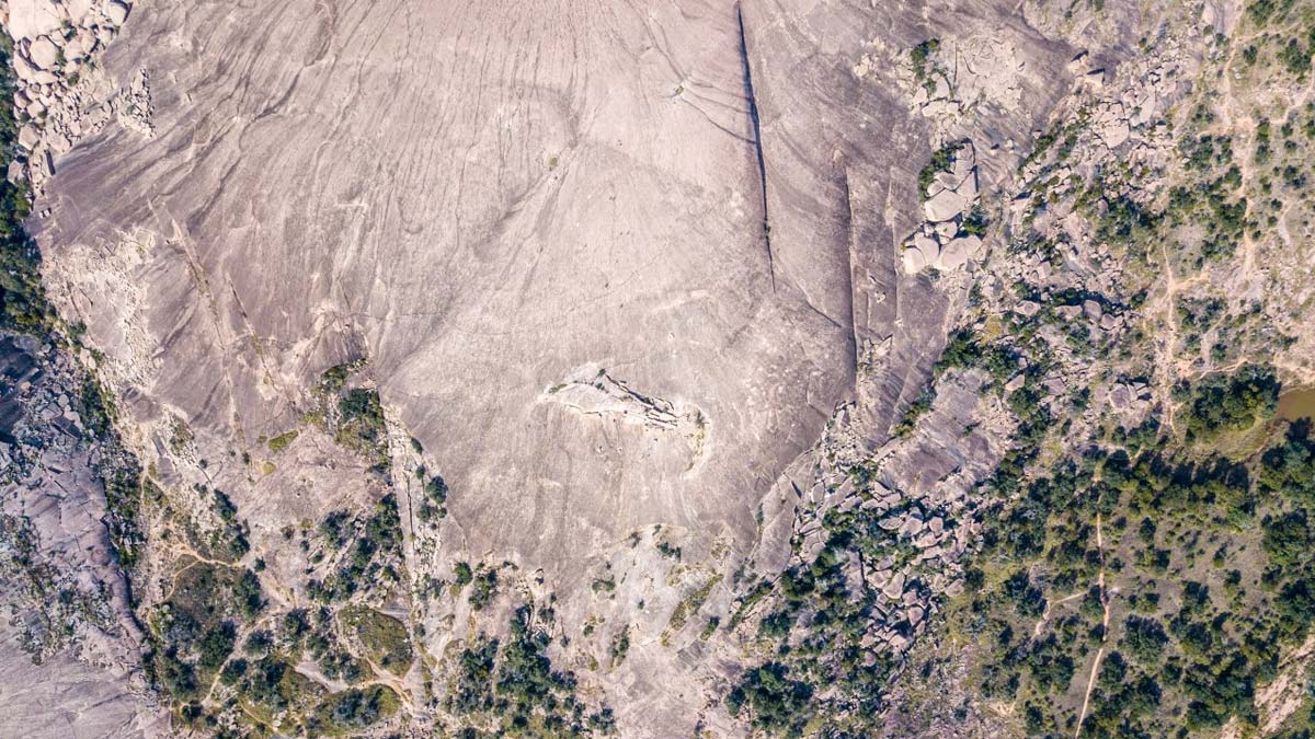
Enchanted Rock State Natural Area in Central Texas has captivated explorers for thousands of years. Over 11 miles of trails meander about the area, but it’s the giant dome of pink granite that Texas hikers come to see and climb. Only 20 minutes north of Fredericksburg and an hour and forty minutes west of Austin, the Enchanted Rock State Natural Area is easy to access and fun to explore.

East Texas
7. Sabine National Forest
The Sabine National Forest lines the east shore of the Toledo Bend Reservoir along the Texas and Louisiana border near St. Augustine, TX. The 28-mile Trail Between the Lakes cuts through the southern end of the forest and connects the Toledo Bend Reservoir to the Sam Rayburn Reservoir to the west. It’s one of those Texas hiking trails that immerses you in the forest but also crosses numerous backcountry roads, making sectional day hikes possible.
8. Sam Houston National Forest
An hour north of Houston, TX, the Sam Houston National Forest sprawls out over 163,037 acres between Lake Conroe and Livingston. The 129-mile Lone Star Hiking Trail wanders through the entire forest, beginning near Richards and ending near Cleveland, TX. A smooth, clear trail and designated camping areas make this one of the best hiking trails in Texas.
West Texas
9. Guadalupe Mountains National Park
Far to the west, the Guadalupe Mountains stack against the southern New Mexico border just 2 hours east of El Paso, TX. More than 80 miles of hiking trails explore these mountains. To the north is the McKittrick Canyon Trail, which follows the bottom of the canyon for about 3 miles before ascending to McKittrick Ridge. And at the south end of the park is the mighty Guadalupe Peak standing at 8,751 feet above sea level. The climb along the Guadalupe Peak Trail is a 3,000-foot ascent over 4 miles rewarded with stunning, panoramic views to the south.
10. Big Bend National Park
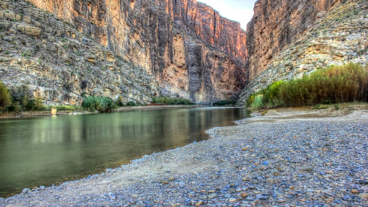
Tucked into the southern tip of western Texas on the Mexican border, Big Bend National Park is a triple-threat for hiking trails in Texas. Mountains, desert, rivers…Big Bend has it all. Go high to summit Emory Peak, the highest point in the park, or traverse the South Rim Trail for the most scenic views of the desert landscape. But don’t miss everyone’s favorite jaunt up the Santa Elena Canyon Trail, which is a short, 1.7-mile round-trip hike between the sheer cliff walls looming on either side of the Rio Grande River.

11. Davis Mountains Preserve
Reaching heights above 8,300 feet, the Davis Mountains in western Texas are a “sky-island” of precipitation isolated by the surrounding Chihuahuan Desert. This unique setting is home to some of the most scenic hiking trails in Texas. Summiting Mount Livermore, the highest peak in the Preserve, is a 6-mile venture from the Madera Canyon Road by way of Bridge Gap.
The Lone Star State does everything bigger, and that includes the diversity of its hiking trails. From the wet forests in the east to the red canyons in the north and the arid desert mountains far away in the west, Texas hiking trails have a little something for everyone.

